Blog
LOMA Screening Tool - Medium Recommendation
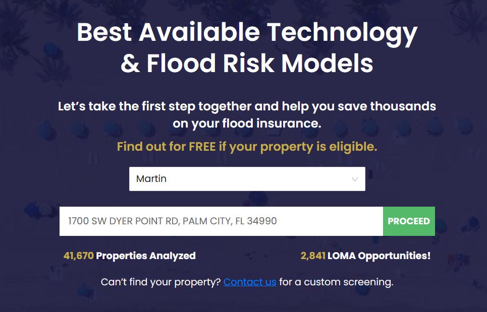
The LOMA Screening tool was developed to help residents in Florida determine their eligibility for a LOMA or Letter of Map Amendment. A LOMA is an official document issued by FEMA (Federal Emergency Management Agency) that effectively removes the high-risk flood zone designation from a property. Due to outdated information and changes in terrain/topography, properties throughout the country may be incorrectly mapped. We use a combination of GIS processing routines and geospatial datasets to estimate the likelihood a property is incorrectly mapped in the high-risk floodplain. The screening tool is accessed directly on the No Flood Florida Home Page. Simply select your County from the drop down as seen below.
When the specific county is selected, two values will appear below the Enter your address bar that show the total number of properties within the county along with the number of properties qualifying for the LOMA recommendation.
We selected a property in Martin County that qualifies for a LOMA.
This property was flagged as a Medium Recommendation which indicates that our estimate of the building structure is at a higher elevation than the Base Flood Elevation (BFE) of the effective FEMA high-risk floodplain.
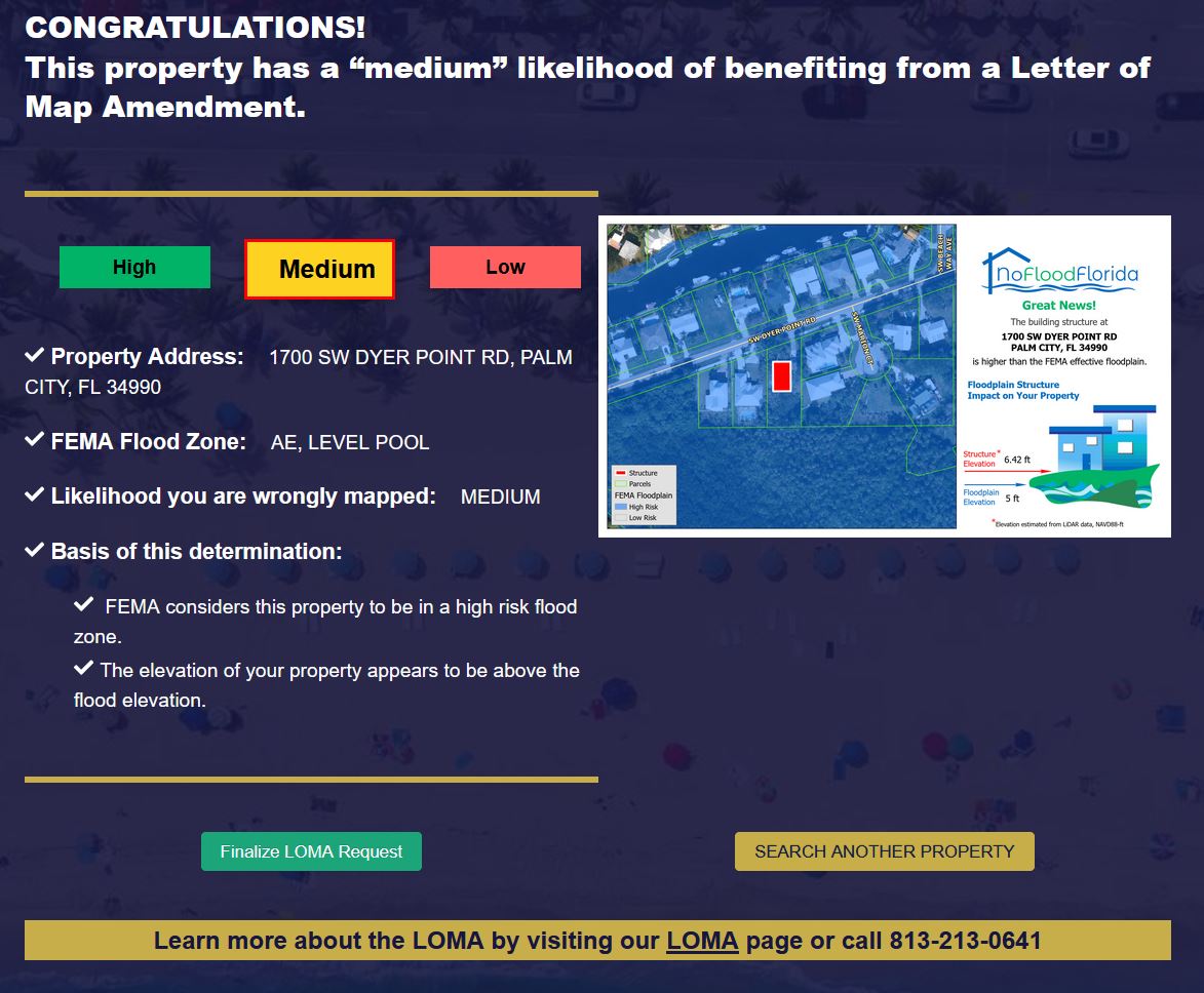
The screening tool returns the address of the property, the FEMA Effective flood zone designation, and the likelihood the property is incorrectly mapped.
Click the picture to view a zoomed in version:
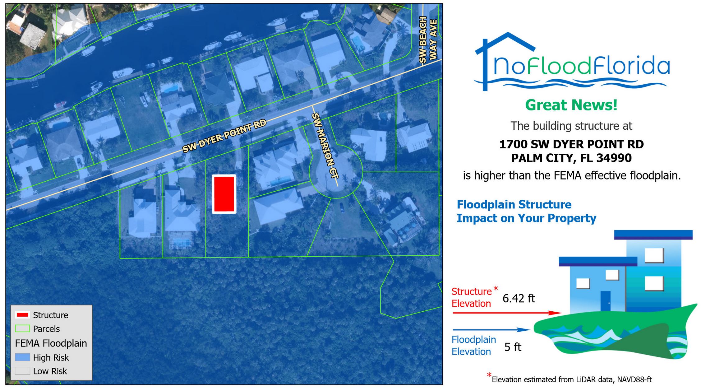
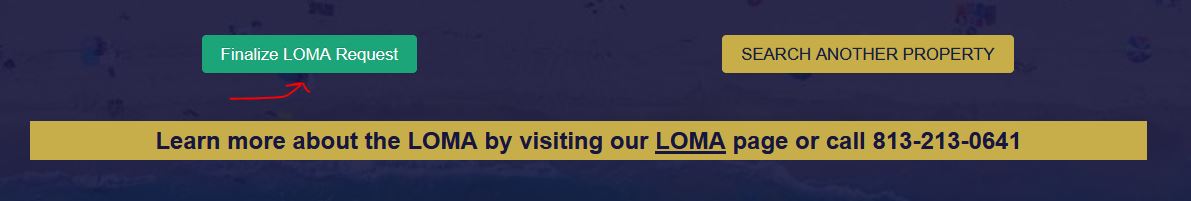
The building structure is estimated to be almost 1.5 feet higher than the Base Flood Elevation (BFE) as defined by FEMA. This property will likely qualify for a LOMA and one can submit a request to No Flood Florida for more information by clicking the Finalize LOMA Request button on the bottom left:
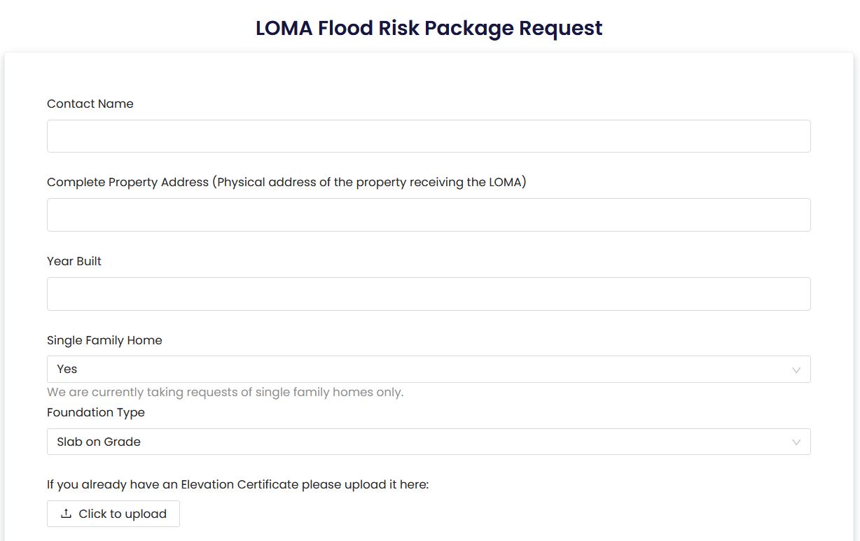
A brief form captures the unique features of your property and some additional contact information so one of our engineers can get in contact with you:
Typically, a Letter of Map Amendment will require an Elevation Certificate. An Elevation Certificate is completed by a Professional Surveyor and defines key elevations around your property. For example, the surveyor will determine the Lowest Adjacent Grade (LAG) of your building along with the Finished Floor Elevation (FFE). These elevations are used directly in the LOMA application process with FEMA and flood insurance estimation. We use LiDAR (Light Detection and Ranging) data to estimate these values and develop the screening tool results. While some older LiDAR information may not provide the same resolution or accuracy as newer products, we have found a close agreement between our estimations of Lowest Adjacent Grade and those reported on Elevation Certificates. A review of the possible logistics for reviewing or obtaining an Elevation Certificate appear below:
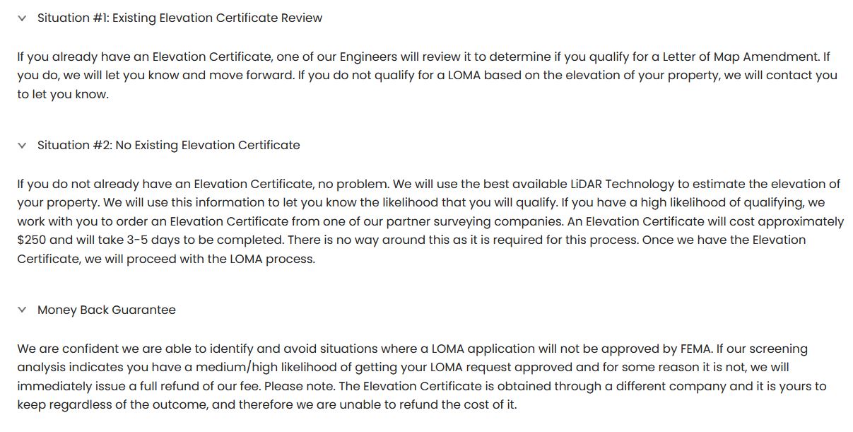
After reviewing the provided or obtained Elevation Certificate, No Flood Florida will determine if a Letter of Map Amendment will be possible. Contact us today for a free review of your Elevation Certificate or to find out more information regarding our LOMA application process.
Taylor Lankford, No Flood Florida, CTO